top of page

Lab of Experimental Real-time Forecasts for Intensity and Gale-scale Size of Tropical Cyclones

We issue forecasts only for named tropical storms over the North Atlantic Basin, whose (forecasted) maximum surface winds are above 34 knots (17.5 m/s) before transitioning to extra-tropical cyclones.
Currently, three types of forecasts are provided: (i) Probability of maximum surface winds, (ii) Radial profile of surface winds, and (iii) Probability of gale-force or stronger winds.
Please click here for more information about the algorithm.
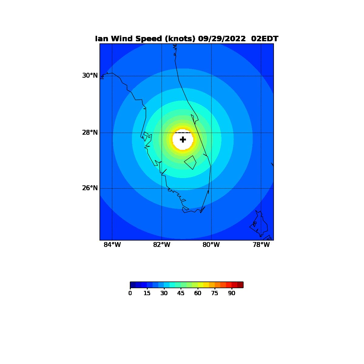
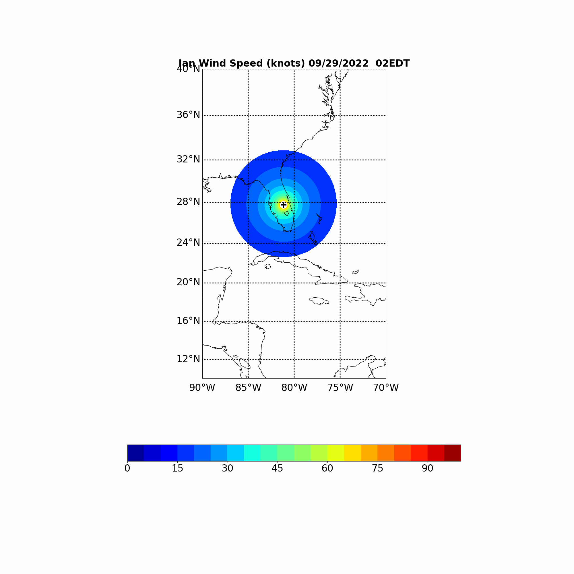
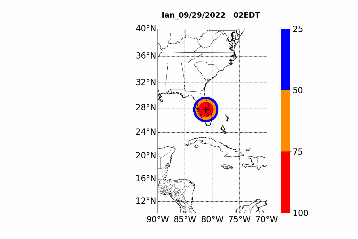
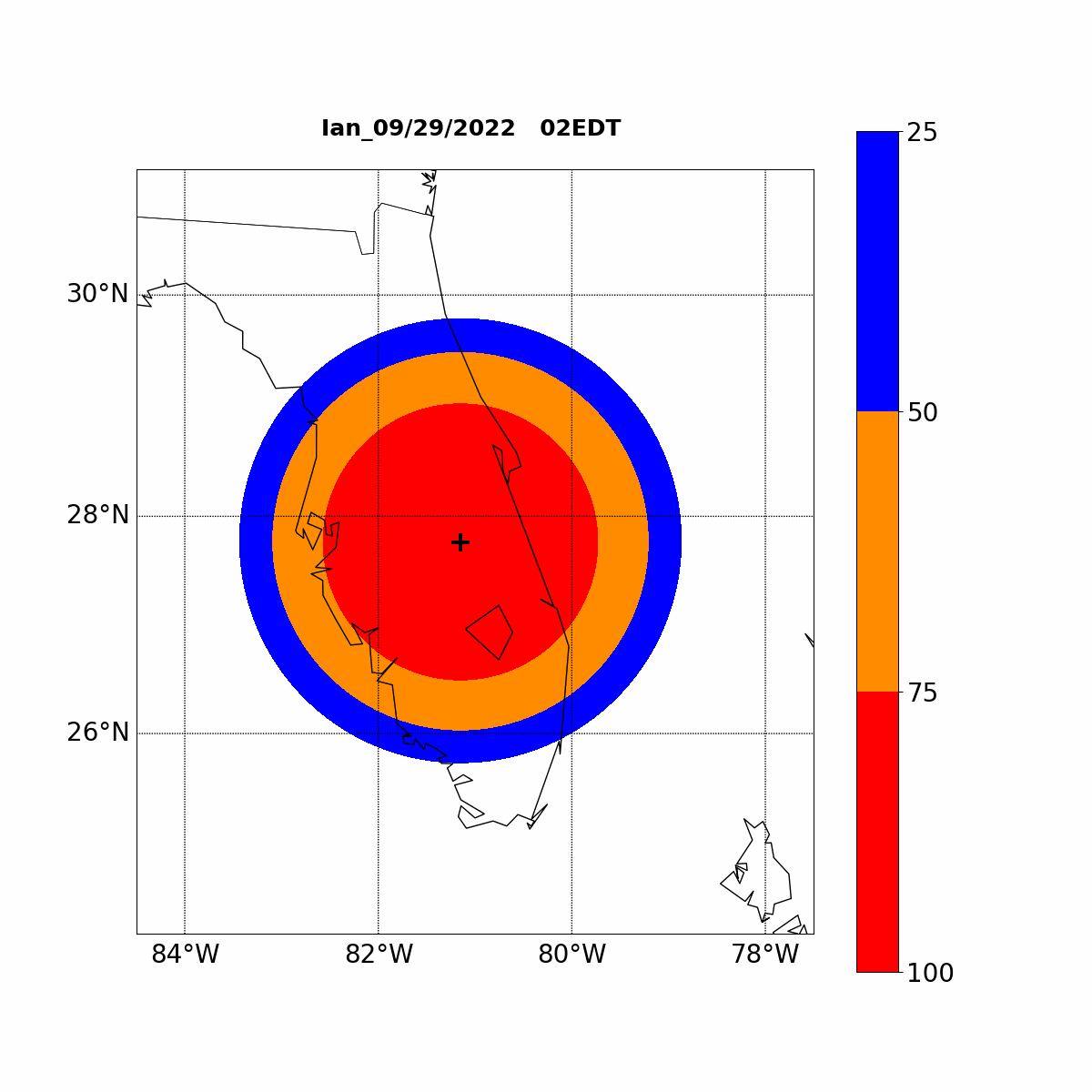
Hurricane Ian
Forecasts of Probability of Maximum Surface Winds
issued on 09/29/2022 2:00 AM EDT

Forecasts of Most Possible Wind Structure
issued on 09/29/2022 2:00 AM EDT
Home: Welcome
Probability Forecasts of Gale-force Wind
issued on 09/29/2022 2:00 AM EDT
Home: About
Home: Subscribe
bottom of page